


Coney Island is readily accessible by parkway, highway, subway and water
 Order this Image
 Original Record
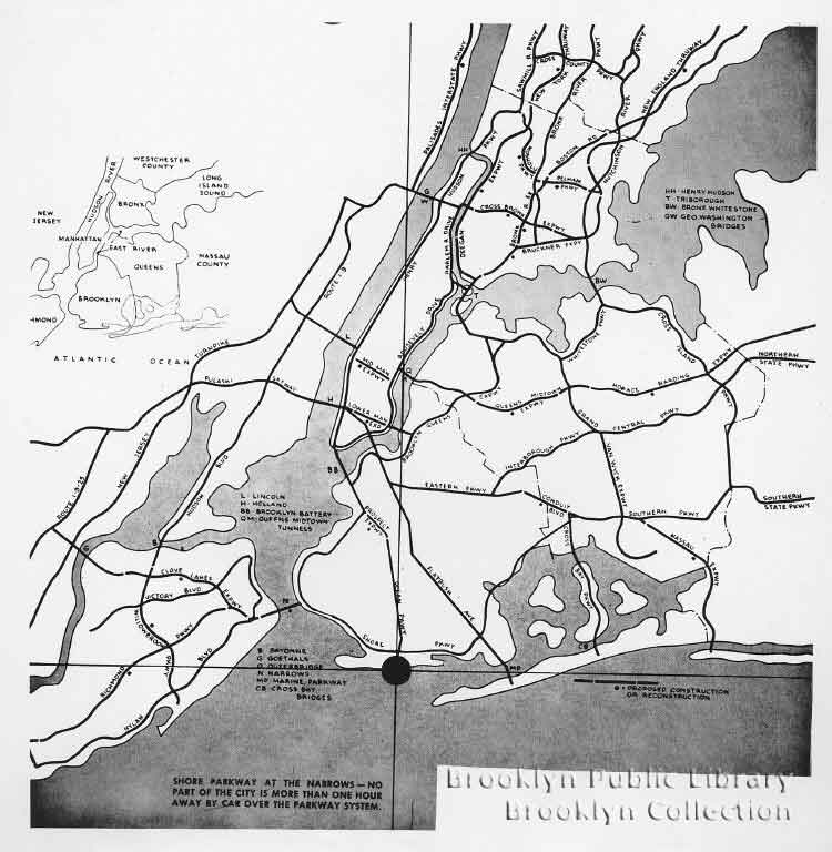
| Title: | Coney Island is readily accessible by parkway, highway, subway and water |
| Description: | Simplified map of New York metropolitan area showing access to Coney Island. At bottom left of photograph: "Shore Parkway at the Narrows--no part of the city is more than one hour away by car over the parkway system." At bottom right of photograph: "Proposed construction or reconstruction." Also on label: "City of New York - Department of Parks - 12-10-52." |
| Date: | 1952 |
| Location: | Brooklyn (New York, N.Y.) Coney Island (New York, N.Y.) |
| Creator: | Brooklyn eagle. |
| More Details: |
On verso: date stamped: Dec. 9, 1952; Brooklyn Eagle stamp. Title from label on verso. |
| Collection: | Coney Island
|
| Subject: |
Maps Urban transportation |
| Institution: | Brooklyn Public Library, Brooklyn Collection. |
| Medium: |
Gelatin silver prints. Photographic prints. |
| Rights: | Copyright restrictions apply to the use of this image. For more information or to obtain a photographic reproduction of this image, contact the Brooklyn Collection at Brooklyn Public Library |
| ID: | CONE 0025 |